Category Archives: Photographs

CTO visit to the Ngorongoro crater in Tanzania

The final day of the Commonwealth Telecommunications Organisation’s Digital Broadcasting Switchover Forum (DBSF) 2014 provided an opportunity for delegates to continue their discussions whilst visiting the magnificent Ngorongoro crater, a UNESCO World Heritage Site situated some three hours drive west of Arusha.  This event, along with many other aspects of the Forum was supported by the Tanzania Communications Regulatory Authority (TCRA), and I would like to take this opportunity to thank Professor John Nkoma (Director General, TCRA) for all of the effort that his magnificent team put into making this what was widely regarded as one of the best ever DBSF event convened by the CTO.  Particular thanks are especially owed to Habbi Gunze (Director of Broadcasting Affairs at TCRA) and to Innocent Mungy (Head of Corporate Communications, TCRA) for everything that they did to ensure that participants were able to hold fruitful and valuable discussions on Africa’s progress towards digital broadcasting switchover by August 2014.

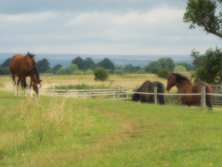
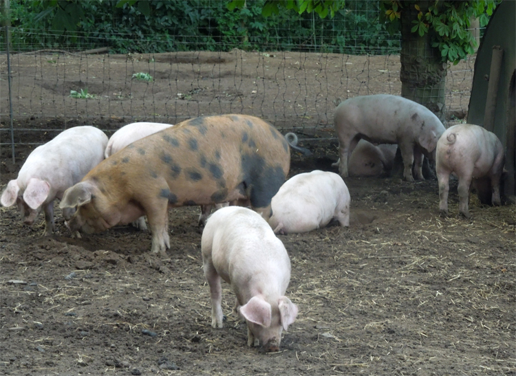
The photos below provide a summary of the magnificent experiences that delegates had in the Ngorongoro crater, and also on the journey between Arusha and the crater.  As I hope these images indicate, the crater itself was very much bigger than I had been expecting and the range of wildlife was truly amazing.

This slideshow requires JavaScript.

After visiting the crater, we spent some time in a small Maasai boma.  A group of children were gathered in one of the tiny huts that served as a pre-school, and it was fun to sing ABCDEFG… with them, and hear them count from one to 10 in very good English.  It reminded me of the images that appeared around 2007 in European and north American media of Maasai warriors with their mobile ‘phones, giving the impression that such devices were becoming more or less universal amongst the Maasai, and were transforming their lives.  I asked one of the chief’s sons whether there were mobile ‘phones in the village, and slightly perplexed he said “No”.  One of my colleagues then asked whether he felt ‘phones would be useful for communicating with friends, and the “warrior’s” response was fascinating, saying much about the resilience of Maasai culture.  “Why do I need a mobile ‘phone?”, he said.  “If I want to see a friend, I walk, perhaps two or three hours to see them”.  I envied him.  What a privilege to walk through such a wonderful landscape, and not to feel the pressures of our modern digital lives.  Perhaps I should not have asked my next question, but he was proud of the children’s learning skills, and wanted to improve his own education.  So, I asked “But if you had a mobile ‘phone, could you not use it to access books and information so that you could learn?”  I should not have asked, because the question embarrassed him.  It reflected a world so different from his own, that it was incomprehensible.  I felt embarrassed too that, although he had given permission, friends with me were using their smart-phones to take pictures of the boma.  I left feeling very challenged.  I’ve long felt that we should never impose digital technologies on the lives of others.  Of course many people think that mobile ‘phones could indeed make the lives of the Maasai very much “better”, but it would certainly be at a cost.  I left just wanting to find a way to give them books for their children, which is what he had asked for.  Perhaps then we could make time to help work with the villagers to design technologies that might enable them to live the lives they want to, rather than the lives so many of “us” want to impose on them of being both a market and a labour force.

4 Comments

Filed under Africa, Photographs

The River Thames at night

Somewhat surprisingly, I had never been on a boat on the River Thames at night until yesterday.  I remember  as a child, when London seemed to have turned its back on the river, which always seemed cold, dark, smelly and unattractive!   Over the last 50 years this has all changed, especially with the opening up of the path along the south bank of the Thames, and the transformation of the old docks into modern offices and residential areas. I had not, though, appreciated just how beautiful it was at night, with the buildings all carefully lit.  I hope that the pictures below do it some justice!  Thanks to Dominc and Caroline for making this possible for delegates at the Education World Forum!

This slideshow requires JavaScript.

Leave a comment

Filed under Photographs

Thames floods at Runnymede, January 2014

I have to admit to being a bit perplexed why so much fuss is being made over the recent flooding in the UK.  Yes, of course there has been damage to property and loss of life, there have been huge waves that have reshaped our coasts, and weeks of rain have given rise to extensive floods in the first few days of 2014.  However, floods are to be expected!  Anyone with the slightest bit of knowledge about rainfall and hydrological systems should know that flood periodicity occurs, and that this can be described statistically.  Thus, we refer to the notion of a 100-year flood as being a flood amount with a 1% probability of occurring in any one year; a 500-year flood has a 0.2% chance of occurring in any one year.  Big floods are expected; we just cannot predict exactly when!  Naturally, flood plains are those areas into which rivers overflow, and historically people knew this and built their properties above the usual flood level.  Looking at the photographs of flooded parts of England, it is fascinating to see that in most cases it is the ancient churches and oldest houses that are most frequently to be seen above the rising water levels.  River management systems seek to deal with the most frequent flood levels, and the challenge is to get the balance right between protection and cost.  Thus, the expense of protecting against 1000-year floods is often prohibitive, and it is generally argued that it is much better simply to pay for repair to the damage of these extreme events.  In Britain, the Environment Agency, for example, provides detailed maps of flood risk, which specifically identifies the areas at risk of 1000 year floods (in pale blue).

Unfortunately, a long period of relatively few floods in the UK in the 195os and 1960s led planners increasingly to build on flood plains, and although the amount of building on flood plains in Scotland and Wales is now very slight, 11% of new builds in England in 2011 were still in areas at risk of 100 year floods.  Some 5.2 million houses in England, representing 23.1% of existing properties are estimated to be at risk of such floods.  This demand by ‘developers’ shows no signs of abating, and a report in 2012 indicated that planning applications were submitted to build as many as 28,000 new homes on land that officials considered to be at serious risk of flooding. It is not nature, or any failings of the Environment Agency that are to blame for the misery of our present floods, but rather the demand for housing and the greed of those who want to maximise profits from house building and other construction on flood plains!  I have to say that with respect to the recent floods it would appear that the Environment Agency has actually done a remarkably good job, and I am dismayed at how critical so many people seem to have been of the flood protection efforts made by recent governments.

Whilst such floods are obviously very sad and damaging for those affected by them, they are a good reminder that nature is actually much more powerful than we often give it credit for, and waterscapes of flooding can indeed be very striking and beautiful.  Below I capture some images taken over the last couple of days of the Thames at Runnymede – as the National Trust sign says, “The birthplace of modern democracy”!

This slideshow requires JavaScript.

1 Comment

Filed under Photographs

Seoul: cyberspace, hospitality and Seolleung

I had the privilege of being invited to participate in the recent Seoul Conference on Cyberspace, which provided me with an opportunity to visit Korea for the first time.  Although most of the three days I stayed there was spent in the COEX Convention Centre, the organisers had also arranged for some of us to go on an ‘industry tour’ which briefly took us out into the ‘countryside’ to the south of the city last Saturday.  The  hospitality of our hosts was both generous and humbling.  I post below some photos that seek to capture that hospitality, and the energy, tastes and beauty that we all experienced.

This slideshow requires JavaScript.

The slideshow captures images from the Seolleung and Jeongneung Royal Tombs,  the amazing music of Miji and the energy of TAL‘s Taekwondo performance at the Gala Dinner, Bongeunsa Buddhist temple, images from the conference, and some more general pictures of the Gangnam area of Seoul.

I left challenged and excited, determined to learn more about how the people of the Republic of Korea have transformed their economy and society in recent years.  Experiencing a tiny bit of Korea, makes me reflect all the more vividly on the observation that in 1960 Ghana and the Republic of Korea had the same per capita income, and I wonder all the more at the very different ‘development’ paths experienced subsequently in Africa and eastern Asia.

3 Comments

Filed under Development, ICT4D, Photographs, Politics

Antigua out of season…

The opportunity to spend a few days of holiday in Antigua was not one to be missed – even if it was in the middle of the ‘so-called’ Hurricane Season! Never having been to the island before, the first challenge was to find a hotel. This was by no means easy, since most were shut for September, and those that were open were mainly offering all-inclusive deals. Can you imagine having to eat in the same hotel restaurant every night, and being stuck on a beach miles from anywhere? Well, if you do, read no further!

Catermaran Hotel 1Restless as we are, and eager to explore as much of where we are staying as possible, we searched long and hard to find a small, relatively hidden away, privately owned hotel. The result was the Catamaran Hotel in Falmouth Harbour – not far from Nelson’s Dockyard – and in the much-to-be-preferred south of the island (although only 30 minutes from the airport). The hotel advertises itself as “a peaceful getaway in an idyllic location” – and that it really was! From the first moment we arrived, the receptionist Annique made us feel incredibly welcome – and even offered us a room upgrade. The small hotel is right on the beach, with large self catering rooms. Although I don’t usually like using air conditioning, it was definitely necessary at this time of year, when the weather was regularly over 30 degrees C in the daytime, with high humidity as well. For most of the week we were here, we were the only guests, and had the swimming pool, a sailing dingy (thanks Robert for the great training), and the small beach all to ourselves. Just nearby is the excellent Bailey’s supermarket which provides most of the daily necessities (including excellent cherry coconut ice cream, plenty of Carib beer, and well-priced Cavalier rum), and a little further afield is the bit smarter Crab Hole Liquors at Cob Cross (where there is also a pharmacy).

Out of season, Antigua is incredibly quiet, with many of the restaurants and facilities shut. The two restaurants just by the Catamaran (the Captain’s Quarters and Cambusa) were both closed, as were most other restaurants on the island! Hence, a car was absolutely essential for getting around! We did our best to travel almost every road, and visit most of the island’s historical sites and beaches! Whilst the north-west of the island is where most of the light industry is located, with houses scattered almost everywhere across the countryside, the south is largely unspoilt with beautiful steep sloping wooded hillsides, and magnificent beaches. Sadly, many of the beaches have large modern hotels on them, largely preventing access to the beaches, and in some instances, as at Half Moon Bay, these hotels have simply been left to decay following storm damage.

Amongst our favourite beaches were:

  • Rendezvous Bay PanoramaRendezvous Bay (near to Falmouth in the south of the island) – needs quite a steep 30 minute walk (each way) to get to unless you have a 4 wheel drive vehicle, but definitely well worth the effort. Sadly, rumour has it that it is subject to development – which would be a huge pity. We had the bay almost to ourselves, and there were lots of fish to be seen snorkeling
  • Windward BayWindward Bay (near Nelson’s Dockyard in the south of the island) – again, needs a short walk, but definitely worth it.
  • Pigeon Beach – a public beach popular with local people, and very near Nelson’s Dockyard. It is a short sail from the Catamaran – but do watch out for the poisonous Manchineel Tree!
  • Long Bay (in the north-east) – despite there being a hotel there, and even at this time of the year with lots of people, there were lots of fish to be seen snorkeling, especially at the eastern end.
  • Half Moon Bay (south-east of the island) is beautiful, despite the decaying hotel!
  • Morris Bay on the south-west coast is also the nicest beach on that part of the island.

Looking at some of the luxury hotels on the island – way beyond our price range – the nicest seemed to be:

  • the Carlisle Bay hotel – for those who can afford at least US$ 674 a night! Perhaps one day!

We took the time to visit many interesting parts of the island – and for those wanting to explore, rather than just getting sunburnt on a beach, the following were definitely worth visiting:

  • Betty's Hope sugar millBetty’s Hope – an old ruined sugar plantation – with a small museum – in the central east of the island
  • Fig Tree Drive – from the centre to the south-west of the island – through lush wooded hillsides, with an opportunity to buy the delicious Antiguan black pineapples from roadside stalls
  • Wallings reservoir – a Victorian reservoir just off Fig Tree Drive, with walking trails up into the hillsides
  • Christian Valley – an agricultural station with trails (hard to find!) from which a rich variety of Nelson's Harbour 3birdlife is visible (sadly now named Obama Mountain National Park – formerly Boggy Peak – seems after all quite appropriate!)
  • Nelson’s Dockyard – definitely worth visiting – the reconstructed 18th century dockyard where Nelson was based between 1784 and 1787 – a haven for English ships during their battles in the region, offering good protection against storms.

TrappasAs for restaurants, most were closed! We were very pleased, though, that Trappas was open (in English Harbour on the road to Nelson’s Dockyard) most of the days we were here, offering largely European style food, but with a touch of Caribbean flavour. The food was well-cooked, reasonably priced (ECD 25 for a starter, and ECD 50 for a main course), and there was a good atmosphere with locals and tourists alike. Nearby, the Mad Mongoose opened while we were here, and offered a livelier atmosphere (must definitely be very lively in season), with slightly cheaper, but still tasty, food.

The only bad eating experience we had was when we were tired and needed a quick drink and lunch in St John’s – and very unfortunately chose to sit down in Cheers. We thought the menu was in ECD (in line with most other restaurants) and only when the bill came, given to us by the unpleasant and supercilious front of house ‘waiter’, did we discover that a simple prawn salad cost US$ 27! Please avoid this horrid place at all costs! Much better would be to go to the nearby Quay Bar and Grill, which seemed much more atmospheric and well-priced – although sadly we did not eat at it!

Below are just a few photos that try to capture just what the beautiful island of Antigua is like out of season. When all of the yacht crews are here it must be very different, and much, much more lively, but taking a risk of the odd storm or even hurricane, and putting up with the higher temperatures and humidity, Antigua is definitely worth getting to know out of season!

This slideshow requires JavaScript.

1 Comment

Filed under Beer, Caribbean, Photographs

Reflections on Montserrat – crafting a viable economy for 5000 people

The chance to work with the Ministry of Communication and Works on the tiny island of Monserrat in the Caribbean last week gave me a rare opportunity to reflect not only on the economic viability of many of the UK’s Overseas Territories, but also on the ways that people living in small island states cope in the aftermath of physical disasters.  Montserrat was devastated by Hurricane Hugo in September 1989, leaving some 11,000 of the island’s population of 12,000 without homes.  Ten people were killed, 89 were injured, and the cost of the damage was reported to be at least $260 million.  In the years afterwards, substantial reconstruction took place, but then in 1995 the island’s Soufrière Hills volcano became active again.  The island’s capital, Plymouth, was soon buried by more than 12 metres of ash and mud, which also destroyed the airport and harbour.  The southern part of the island became uninhabitable, and a strict exclusion zone was introduced to limit future loss of life.  Then, in 1997 a pyroclastic flow passed down Mosquito Ghaut, overflowing the valley sides and killing 19 people who were in the exclusion zone.  Subsequently, there has been ongoing volcanic activity, mostly consisting of ash falls in the south of the island, but in 2009-10 further pyroclastic flows also occurred.  This double disaster had immense impact on the island’s population, with some 8,000 people choosing to leave, primarily for the UK which had granted the islanders full residency rights in 1999, and British citizenship in 2002.

Although I broadly knew about the island’s history, it is impossible to appreciate both the impact of these physical disasters, and the resilience of the people without actually visiting the island, and standing on the hillside overlooking the devastated city of Plymouth.  Having spent a couple of days with Montserratians before visiting Plymouth, and appreciating something of their warmth and generous hospitality, I was left with an overwhelming sense of sadness just standing on the edge of an ash filled swimming pool overlooking the devastated landscape of the island’s former capital.

This slideshow requires JavaScript.

Monserratians are determined people, and those who I met were adamant about not only their British citizenship, but also their love for the island and their wish to ensure that it has a viable economy for the future.  The cost of the necessary reconstruction and development is nevertheless very, very substantial.  Much is already being done: there are plans for a new harbour; geothermal drilling is underway to see whether it could provide a source of energy for the future; and a submarine cable is to be laid to support their international digital connectivity.  However, much still needs to be done to ensure that the island can once again be self-sufficient as it was before the volcanic eruptions.  The challenge is that it is extremely difficult to identify how best this can be achieved, especially with such a small population.

From my very short visit, it is not easy to see the niche areas that the Monsterratians can build upon to regain their economic vitality.  Thinking back to the late 1970s when the Beatle’s producer George Martin created the AIR studios, Montserrat was able to attract some of the world’s most famous musicians to its green and peaceful environment.  There are still beautiful landscapes on the island, but the nature of the recording industry has changed so much that it would be difficult to imagine such an ‘adventure’ working again.  Perhaps, though, George Martin’s house (Olveston House – on Penny Lane), which now serves as a most welcoming guest house for visitors, does indicate one way forward, in that the island could carve itself out as a niche for high quality, environmentally sensitive tourism.  It is certainly beautiful, and the people most friendly.  However, its airport is tiny, with the runway only able to take very small planes, and it requires a new, much larger harbour to attract cruise ships and yachts to the island. There remains, though, the inevitable “chicken and egg” problem: visitors will not come unless there are high quality facilities on the island, and few people are willing to invest without there being strong prospects for sufficient visitor numbers to enable them to recoup their investments.

On the more quirky side, any country has to turn to its strengths and opportunities.  The volcano itself is a source of interest to visitors on the neighbouring islands, with air tours regularly bringing people from Antigua to visit.  It seems a shame that Montserrat itself currently benefits relatively little from such initiatives, and it must be possible for innovative initiatives to be developed that could enable Montserratians to reap dividends from such opportunities.  For film makers wishing to produce films in apocalyptic settings, the old capital of Plymouth on Montserrat would make an ideal – albeit highly risky – setting!  The island is also known as the Emerald Isle of the Caribbean, not only because of its lush vegetation, but also because it was settled by Irish immigrants from St. Kitts.  The potential for its Irish heritage to be marketed much more strongly, could also foster enhanced tourism from Éire.  Some of the bays in the north of the island would also make ideal facilities for luxury yacht marinas, and their development could offer a very different kind of destination for those sailing the Caribbean.  Finally, the ultimate strength of any country is its people, and there is no doubt that better connectivity to the Internet will enable those who wish to stay on the island and build economic activity around the provision of digital services will  be able to do so much more effectively once the new cable is completed.  Already, one software company (Lavabits) is developing its business there, and with an educated population, well-connected to the diaspora living in the UK, there has to be further potential for the islanders to use the Internet, not only to attract tourism, but also to build a new digitally-based economy in Monsterrat.

It was a real privilege to spend time on the island.  I admire the resilience, fortitude and determination of those whom I met, and I greatly appreciated their warmth and generosity.

1 Comment

Filed under Caribbean, Commonwealth, ICT4D, Photographs, Politics, UK

Habton House Farm Bed and Breakfast: an excellent place to stay in Yorkshire

HH2For anyone looking for somewhere to stay to the north of York,  I’m adding to my periodic comments about interesting hostelries and places to stay by recommending Habton House Farm.  This is an exquisite, hidden-away 200 year old Grade II listed farmhouse situated in the small hamlet of Little Habton just to the north-west of Malton, and not far from Castle Howard.  It makes a great place from which to visit the North York Moors and the Vale of Pickering, with both York and Scarborough each being less than an hour away.  The rooms are beautifully decorated and the quality of furnishings and services offered have been chosen with great care and are of a very high standard. I particularly liked the choice of bath oils and soaps (Bamboo from Bath House if I recall correctly) – as well, of course, as the teas!

HorsesHowever, above all this, what really makes the place is the friendly, welcoming hospitality of James and Lucy who have worked enormously hard to create this very special place to stay.  They have a really magical touch of making guests feel very much at home, getting just right that difficult balance between being open and friendly, while at the same time giving space to guests who just want to escape and be alone.

The breakfasts are also really special!  They offer a good range of delicious food – from bacon and eggs produced on their smallholding, to porridge, smoked salmon and home-made jams and marmalade; and, for the healthier minded, don’t forget the fresh fruit salads and fruit compote!  All of the guests sit around one large breakfast table – which can be a bit daunting for some – but this offers a great opportunity for interesting conversation!

HH1With only three double rooms, there are never many people staying, and there is plenty of room to relax.  Guests have use of a lovely drawing room, which has a log fire in the winter, and for those who cannot escape being an appendage to a digital device there is good quality Wi-Fi, as well as a television in each room, and DVDs to borrow in the drawing room.  Nearby are several good restaurants, and James and Lucy are always on hand to recommend somewhere interesting to explore.  We certainly had a very pleasant pub dinner at The Grapes in Great Habton!

PigsTheir smallholding specialises in breeding and rearing rare-breed pedigree Oxford Sandy and Black pigs, and has pioneered the ultimate in food provenancing by enabling people to adopt a pig, and follow it throughout its life until the time comes to enjoy a wonderful porcine feast!  Mind you, the bacon at breakfast is also very, very good!

All in all, if you are looking for a quiet, luxurious place to stay in Yorkshire, at very good value, and with really friendly young hosts, this is definitely somewhere you should get to know!  I really hope that James and Lucy make a success of this venture – and that by encouraging others to come and stay I can express something of my gratitude to them for a really lovely weekend!

1 Comment

Filed under Photographs, Restaurants

Full moon over Virginia Water

Sitting out last night it was amazing seeing the nearly full moon rise in the sky.  It was easy to understand how powerfully our prehistoric ancestors felt about the sun, moon and stars!  This picture does not quite do it justice.  In reality, the colour was much redder, and indeed brighter!

Moon over VW

Leave a comment

Filed under Photographs

Hostageria de Poblet: peaceful place to stay to the west of Barcelona

There is always a tension in writing about hidden away places where I have enjoyed staying.  Were they to become overly popular, that would destroy much of their secrecy and solitude!  However, earlier this year I discovered somewhere really lovely, and hope that by mentioning it here others will take the opportunity to enjoy what it has to offer.

The Royal Monastery of Santa Maria de Poblet in La Conca de Barberà just to the north of Reus and Tarragona, and some 130 kms west of Barcelona, is one of a group of Cistercian monasteries founded in Catalunya in the 12th century, shortly after the conquest of the province by the Catalan-Aragon monarchy.  Others  include the monasteries of Vallbona de les Monges in l’Urgell and Santes Creus in L’Alt Camp.  One day I must walk the Ruta del Coster that joins them all up!

The monastery of Santa Maria de Poblet itself had become very run down by the early 19th century.  The confiscation of church lands in 1835 and the consequent expulsion of the monks led to further decay, and it has only been in recent years that some of its character has been restored.  A community of monks returned to the monastery in 1940, and in 1991 it was declared a World Heritage Site by UNESCO.  Since then it has attracted increasing numbers of visitors, many of whom are drawn there by its magnificent setting among woods and streams sheltered by the Prades mountains.

In 2010 a new modern guesthouse, the Hostageria de Poblet, was built within the old walls of the monastery, and it provides a simple, minimalist place to stay. For those who like quiet, hidden away places, set amidst vineyards and rolling hills, the Hostageria is most definitely worth a visit.  As their brochure notes, “There are no televisions in the rooms to respect the silence and the living dynamics of the monastery”.  That having been said, the guesthouse does have Internet access for those who do not want to escape the modern technological world completely!  Currently, the Spring price for a double room varies between $49 and $59, which makes them really excellent value for money.

The Hostageria also has a restaurant that serves delicious local food – but do note that the lunch menu is much more extensive than that available in the evenings.  Alongside the restaurant is a culinary school, designed to provide both a theoretical and practical training for people living in the comarca of Conca de Barberà.  The Spring menu offers three courses for €20, with a typical choice being

  • Torradeta d’escalivada i formatge de cabra gratinat
  • Llom de bacallà a la mel a l’estil dels monjos de Poblet
  • Iogurt del monjos amb gelat de nata i xarrop de grosella

The monastery also has its own wines, developed in collaboration with the Cordoniú Group. Nine hectares within the walled enclosure were planted in 1989 with Pinot Noir grapes, chosen in memory of the Cistercian wine makers of Burgundy.  Although Pinot Noir is not widely grown in Catalunya, the wines from the monastery, include the 100% Pinot Noir Abadia de Poblet, as well as a lesser wine known as Intramurs, which is a blend of Cabernet Sauvignon, Tempranillo and Merlot, and both are definitely worth tasting while staying there.

This slideshow requires JavaScript.

Leave a comment

Filed under Photographs, Restaurants, Wine

Valuing the impact of wind turbines on rural landscapes: Conca de Barberà

I have been lucky enough to spend a few days walking in the Conca de Barberà county, or comarca, in Catalunya, and was very surprised – and indeed saddened – to see the visual impact of large numbers of wind turbines almost wherever one looked.  The selection of images below gives an indication of the scale of the issue:

This slideshow requires JavaScript.

Whilst it was a cloudy day, and the images do not do full justice to the visual impact, especially around the small village of Flores, these pictures do convey something of the dramatic change they have made to the landscape.  Moreover, standing next to them one can also most definitely appreciate the noise impact they have – no longer are these hilltops a place of silent reflection, tempered only by the song of birds and the occasional dog barking in the villages nearby!

This raises very real questions about how landscapes are valued, and the politics of energy.  There have been many attempts to place a ‘value’ on landscape change, but these have mostly focused on somehow trying to calculate an economic cost of the change, often in terms of the loss of income.  Thus, if an area has previously gained an income from tourism, and the landscape change means that this is reduced, then it is clearly possible to estimate such a loss.  Other measures draw on the amount that people would actually pay not to have a change imposed on a landscape.  However, it is actually extremely difficult to place any kind of economic value on the emotional impact of a landscape change.  This area of Catalunya is at the heart of the Ruta del Cister, the triangle of Cistercian monasteries that were built there from the 12th century onwards.  The impact of the wind turbines has completely transformed the peace and tranquility of the landscapes, in a way that no simple economic measure can ever grasp.  Although some people might  think that these human feats of engineering have an attraction of their own, representing progress that no medieval Cistercian nun or monk could ever imagine, I find the juxtaposition of these two cultures concerning and depressing.

Reflecting on this dramatic transformation, I started to think further about the two kinds of power that this transformation represents.  On the one hand, the wind turbines represent the physical power of a new means of producing electricity.  However, each turbine actually only produces relatively little power. Estimates vary hugely, but as a general figure it is often argued that one turbine can produce enough energy for around 500 households a year – depending on the efficiency at which they function.  All the turbines in the images above therefore produce really rather little electricity, but at a very significant change to the landscape.  This transaction reflects a second kind of power, political power, since it illustrates yet another way through which a largely urban population exploits rural areas for their own interests.  This despoliation of the landscape is nothing other than a means through which the urban bourgeoisie seeks to maintain its ever increasing patterns of consumption.

Surely it would be much ‘fairer’ for the environmental cost to be paid by those living in urban areas, by for example constructing new styles of energy efficient housing and taxing air conditioners, rather than destroying the rural landscapes that they rarely visit, either physically or in their imaginations!

7 Comments

Filed under Photographs, Wildlife